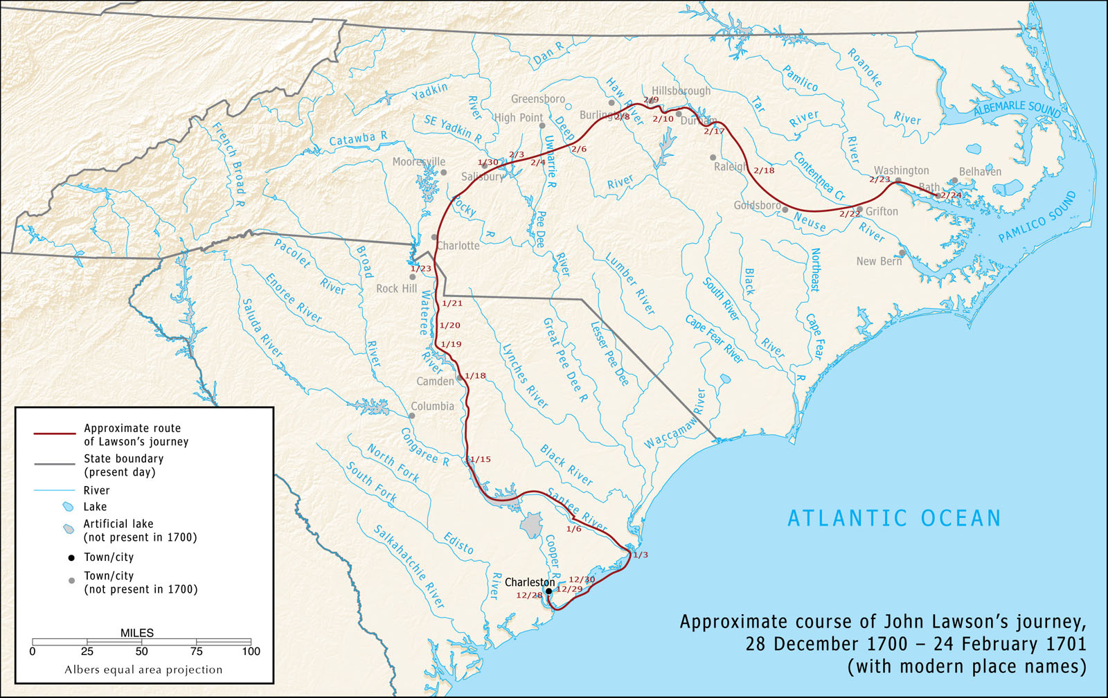
I created this map for LEARN NC in 2009 to show the approximate route of John Lawson, who explored the Carolinas in 1700–1701 and documented his travels in A New Voyage to Carolina (1709). I had intended the map to accompany a web-based critical edition of Lawson’s book, but I wasn’t able to finish the project.
I drew a new version of this map for The Curious Mister Catesby: A “Truly Ingenious” Naturalist Explores New Worlds, published by the University of Georgia Press in 2015.
Here’s how a bit about how I made the map, from my description at LEARN NC:
Tracking Lawson’s route is not a simple task. Although Lawson estimated his daily mileage, he didn’t estimate mileage every time he stopped, and he was not always accurate — certainly not accurate enough to place him reliably on a modern map. He noted the names of rivers he crossed, but as one of the first Europeans to explore the backcountry of Carolina, he often called rivers by different names than they were later given or guessed wrong about which major river’s tributary he had found.
Although Lawson mentions several Indian towns, we don’t always know where those towns were. Archaelogists haven’t located every Indian site in the Carolinas, of course, and the Indians didn’t leave written records. Many of the Indian groups in Carolina moved every generation or two, and it is impossible to know which site Lawson may have visited. Many of these groups were in flux when Lawson found them; several had been nearly wiped out by disease, and many groups moved and combined with others in the early eighteenth-century.
Worse, when we compare Lawson’s estimated mileage, the rivers he describes, and what we know about the people he met, we often find that the information available to us is contradictory!
The Congarees, for example, were found in 1715 living on the west bank of the river that today bears their name, in the vicinity of present-day Columbia, South Carolina. Yet it appears that Lawson found them in January 1701 on the northeast bank of the Santee, below the junction of the Wateree and Congaree Rivers. The Wateree Indians, whom he met a few days later, lived near present-day Camden, but they too had moved by 1715.
Because of difficulties like these, every map of Lawson’s route is a little bit different.